Hand drawn tourist map of New Jersey's prisons, 1955
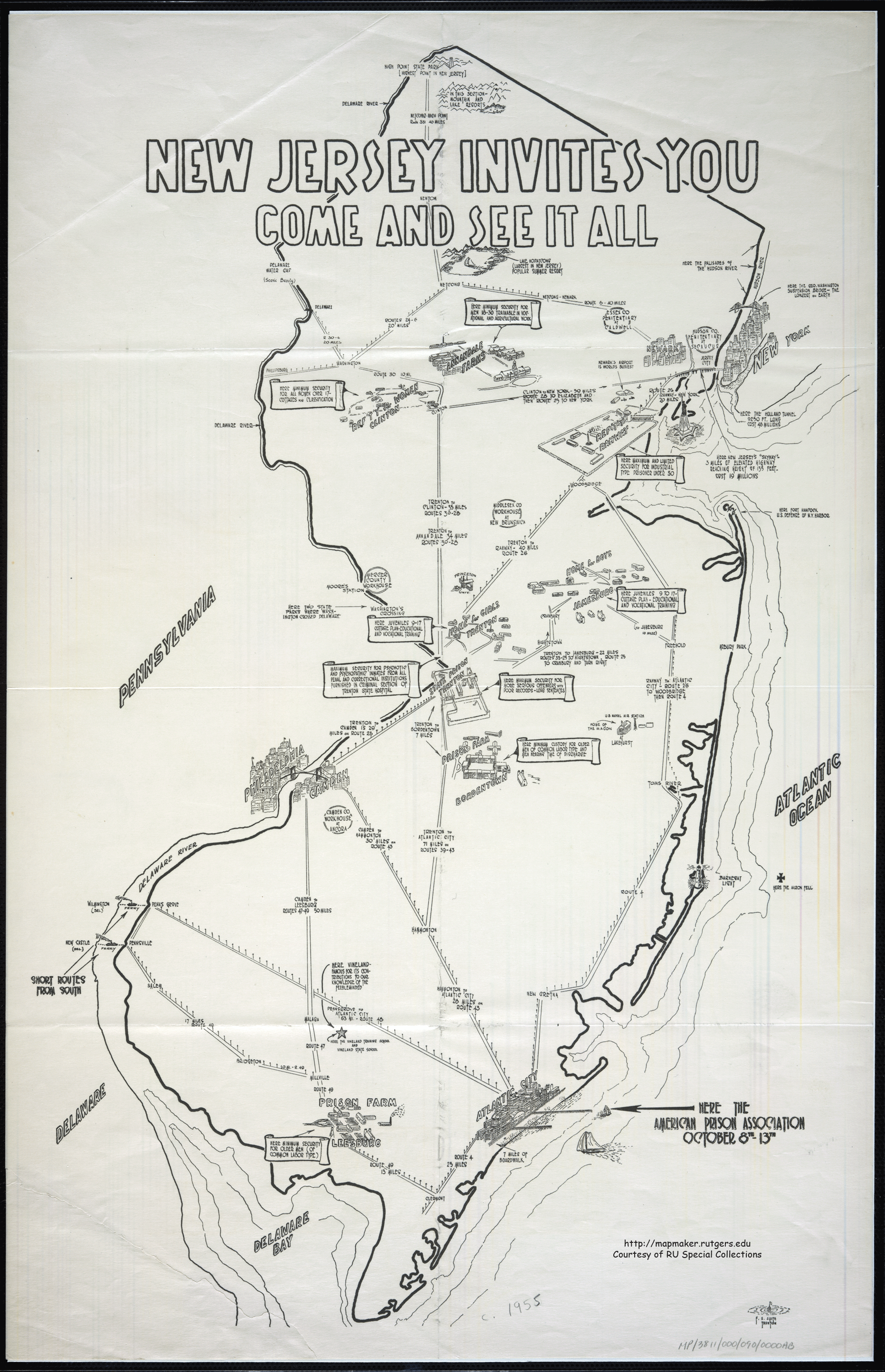
Jim sez, "Rutgers has an interesting collection of historic maps online, including what appears to be a 1955 tourist map ... of prisons."
GIF Link (Thanks, Jim!)
The hand-drawn map has normal touristy captions notations like:
- High Point State Park [Highest Point in NJ]
- Lake Hopatcong (largest in NJ) Popular Summer Resort
- Newark's Airport is world's busiestBut the map is dominated by prisons:
- Here maximum and limited security for industrial type prisoner under 30 (Ref't'y Rahway)
- Here minimum custody for older men of common labor type and men nearing time of discharge (Prison Farm Bordentown)
- Here minimum security for men 18-30 trainable in vocational and agricultural work (Annandale Farms)


the latest
latest episodes
It seems like the map was a promotional item for the American Prison Association's conference in Atlantic City in October, c. 1955. I like that the big arrow pointing towards the conference makes it seem that it will take place on a small sailboat. :D
Well, "prison architecture" is a worthy subject all on its own.
I can see a small fandom of prison architecture ("prarchies"?) doing a guide to the most impressive prisons.
Personally, I find a lot of 19th-century prisons impressive (in an "it's a nice place to visit, but I wouldn't want to live there" way), what with lots of handsome brickwork and iron scrollery to admire. (See SHAWSHANK REDEMPTION.)
cory, thank you so much for posting this, as a life long jersey resident i love this. I adore its hand drawn-ness that no longer exists in the world today.
Dartmoor prison in the UK (still in active use) attracts a number of tourists, due to its notorious history and scenic location. There's even a museum and gift shop where one can buy novelties made by the prisoners.